


'); background-image: linear-gradient(180deg, rgba(25, 67, 136, 0.7), rgba(25, 67, 136, 0.7)), url(' ');"
>
');"
>
');"
>
');"
>
Output from the National Weather Service SLOSH model indicating simulated water level heights from Hurricane Ike along the Texas and Louisiana coasts.
NOAA
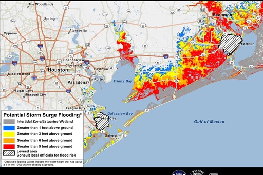
A potential storm surge inundation map near the Gulf of Mexico
NOAA